Spotlight for Caribbean American Heritage Month: historical maps displaying the Caribbean region from the Cuban Heritage Collection and UM Special Collections.
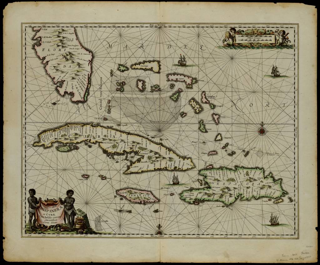
Insularum Hispaniolae et Cubae Cum Insulis circum jacentibus accurate delineatio (“Accurate delineation of the island of the Hispaniola, Cuba, and surrounding islands”), 1650. Rare sea chart of Southern Florida and the Western Caribbean. Decorated with rhumb lines, two compass roses, sailing ships, a title cartouche and a mileage scale. From CHC, Cuban Map Collection (digitized).
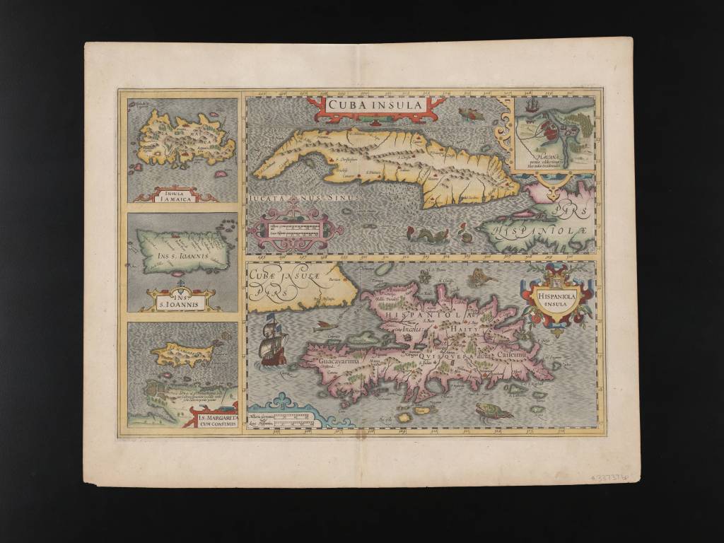
Cuba Insula. Hispaniola Insula. Ins. Iamaica. Ins. S. Ioannis. I.S. Margareta Cum Confiniis. (“Mercator-Hondius map of Cuba, Puerto Rico, Hispaniola and Jamaica, with inset of Havana”) 1619. Cuba is prominently displayed, encompassing the Cayman Islands, Isla de Pinos, and a portion of Hispaniola. The map is adorned with sea monsters and sailing ships. From CHC, Cuban Map Collection (digitized).
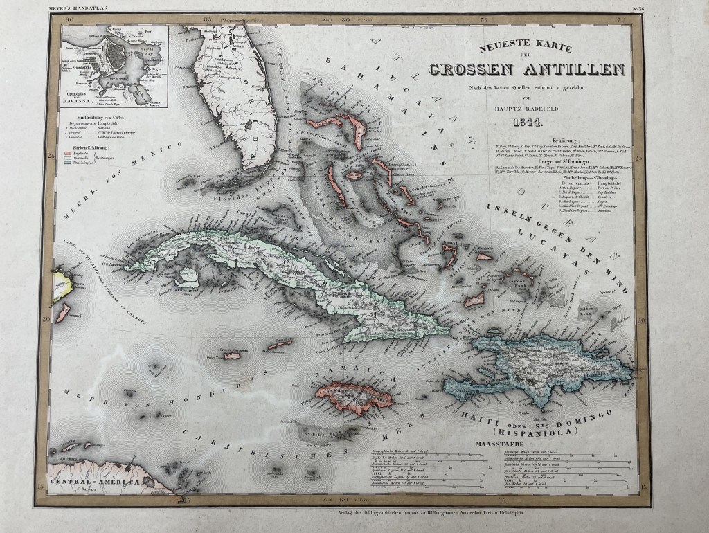
Neueste Karte der grossen Antillen, 1844, Regional map outlined in color, showing part of Florida and the Caribbean. It depicts the tip of Yucatán and a small part of central America. It includes an inset of Havana in the upper left corner. The islands are colored according to their European ownership: orange – English; green – Spanish; blue – independent. From UM Special Collections.
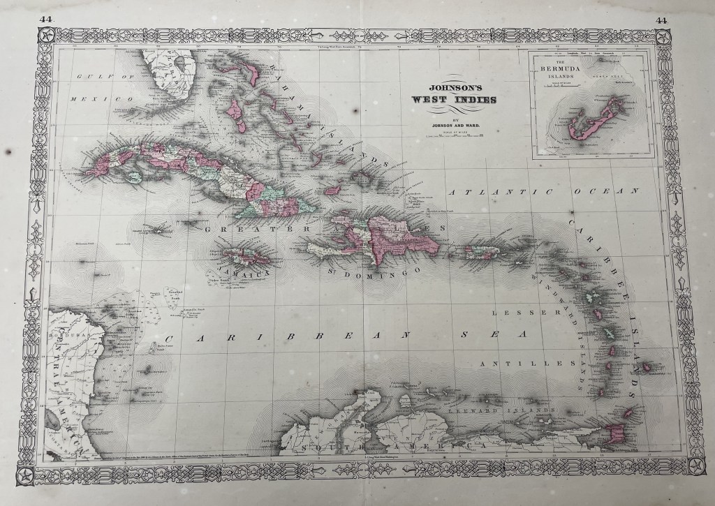
Johnson’s West Indies, 1864, A.J. Johnson’s map covers from Florida to Venezuela and from Honduras to Barbados. It also includes the Bahamas, Cuba, Jamaica, Santo Domingo (Hispaniola), Puerto Rico and the Lesser Antilles or Windward Isles. In the upper right quadrant, there is an inset of Bermuda. From UM Special Collections.
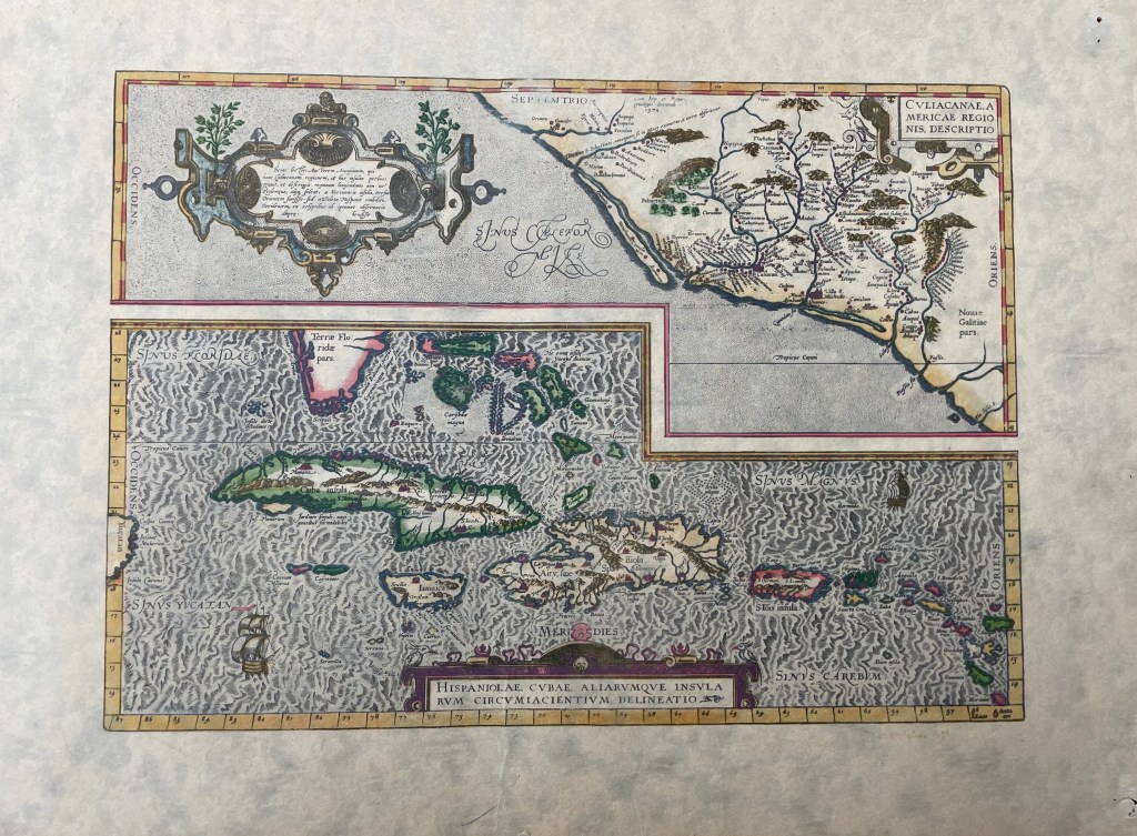
Culicanae americae regionis descripto, 1579, Map showing South Florida, including hints of the Florida Keys, and the Caribbean. The map extends from the tip of the Yucatán and names Cayman Magnus and the “Caymanes;” provides detail of Cuba, Hispaniola (Dominican Republic and Haiti); and features Puerto Rico, Jamaica, and St. Jois Insula (St. Johns), the Bahamas, Virgin Islands, and the Windward Islands. From UM Special Collections.